A massive Pacific storm over the weekend brought powerful wind, torrential rain and heavy snow to the western U.S., causing widespread power outages, major travel delays and a mudslide near Malibu, California, near where the Woolsey Fire recently burned through.
In the Seattle metro area, winds topped 60 mph and resulted in thousands of power outages on Sunday, as more than a foot of snow fell in the Sierra Nevada. Mountains outside of Salt Lake City saw more than 2 feet.
More heavy rain in the Bay Area created flooding on Sunday night, following strong wind and high tides on Saturday. This powerful storm has moved east as part of an active pattern delivering winter weather coast to coast in the next few days.
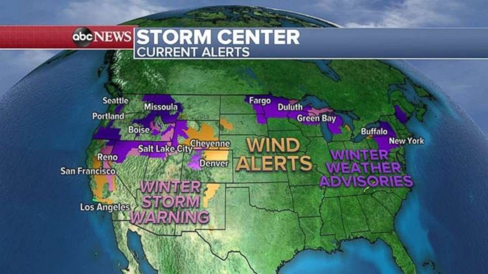
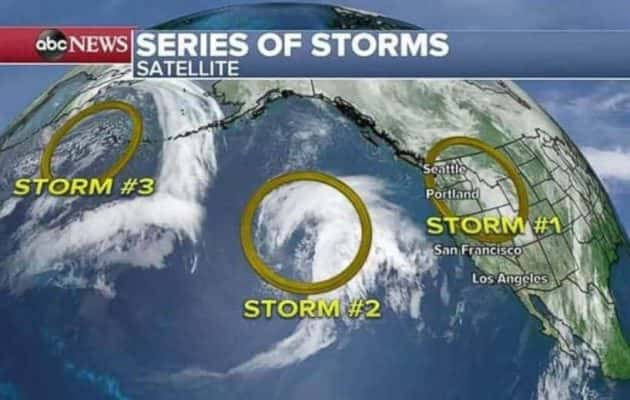
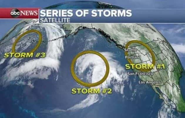
After getting out from under that major Pacific storm, the West Coast is expecting two more this week. More rain and snow are expected, as whiteout conditions are possible today in the Sierra Nevada, where total snow accumulations from the weekend through today could top 4 feet.
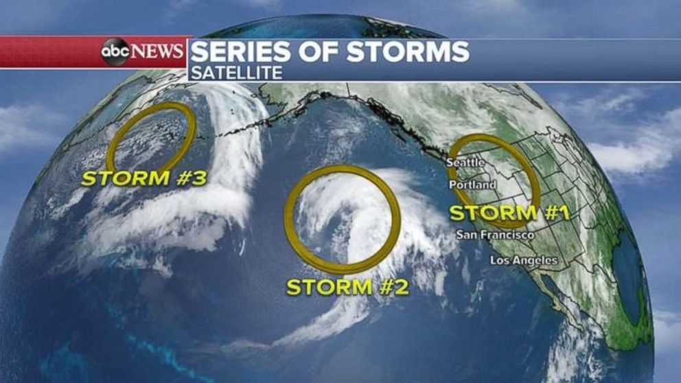
The next Pacific storm is due to arrive early later on Tuesday and could be a tad wetter. Heavy rain is expected in much of Northern California and the Northwest, with more snow forecast for the mountains. Rainfall totals of 2 to 4 inches will be possible.
The following Pacific storm is lurking near the Aleutian Islands off Alaska. That storm’s potential impact isn’t clear at this time.
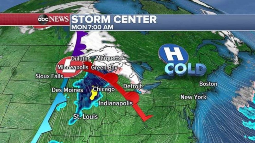
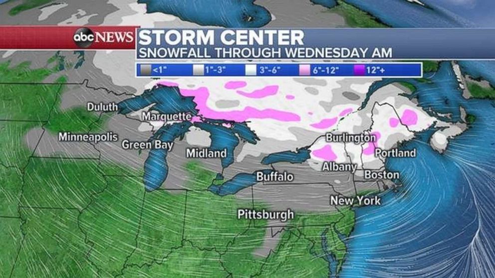
This morning, that storm that just left the Pacific is delivering wintry precipitation to parts of the upper Midwest, with a foot of snow possible today on parts of Michigan’s upper peninsula.
The storm is expected to quickly slide off to the east today and deliver snow to New England by Tuesday morning, with snow and a wintry mix possible throughout the suburbs of New York and Philadelphia. The major cities are more likely to see just rain.
Snowfall totals should remain light across much of the Northeast, but a few areas could see 3 to 6 inches locally, leading to travel issues.
